Android intervalometer & sky planner

The sunset you will actually see. Stars exactly where they shine.

A time-lapse shot by your own camera app, with everything it can do – and the Sun, Moon and stars drawn over the real landscape.

Free · No ads · Android 11+

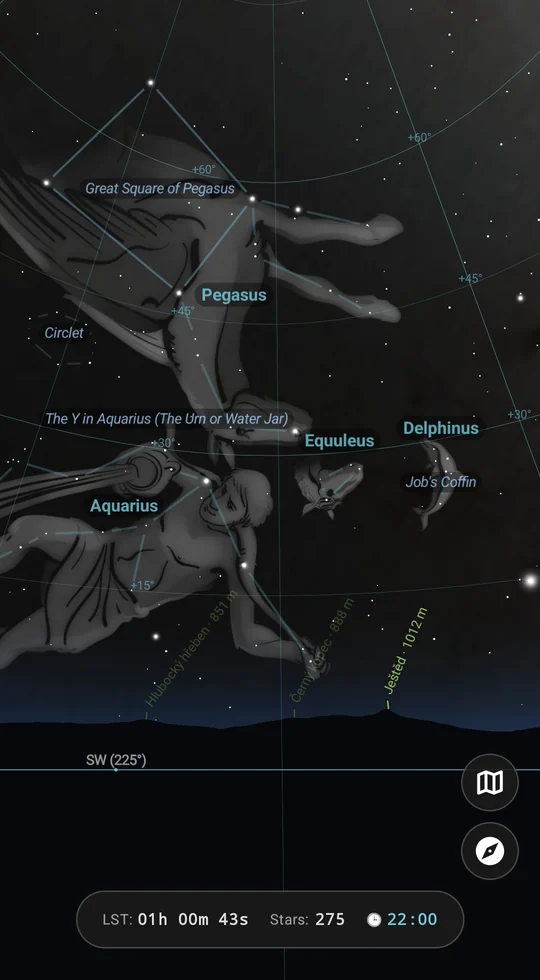
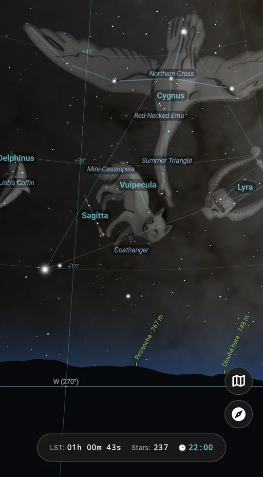
Night Sky AR: constellation figures above the real horizon, with the names of the peaks on the skyline
  • 88illustrated constellations
  • 110Messier objects with photos
  • 5languages
  • 0ads, trackers or accounts

Three tools, one app

Plan the shot. Then let the phone take it.

Time-lapse without compromise

CAELIS presses the shutter inside the camera app you already use, so every frame keeps your phone's HDR+, Night Sight and astro modes.

Learn more

Sun & Moon in AR

Their paths over the live camera view, with time marks, golden hour and twilight – against the real horizon from a terrain model.

Learn more

Night sky in AR

Stars, planets, the Moon and the Milky Way over the real landscape, with rise and set times against the actual hills.

Learn more

Time-lapse

Your camera app. A schedule that never drifts.

  • Shutter inside your camera app – Google Camera or any other
  • Drift-free schedule – a late frame never pushes the whole series
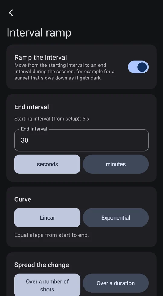
  • Interval ramping, linear or exponential – made for sunsets
  • Auto-stop on shot count, duration, battery or free storage
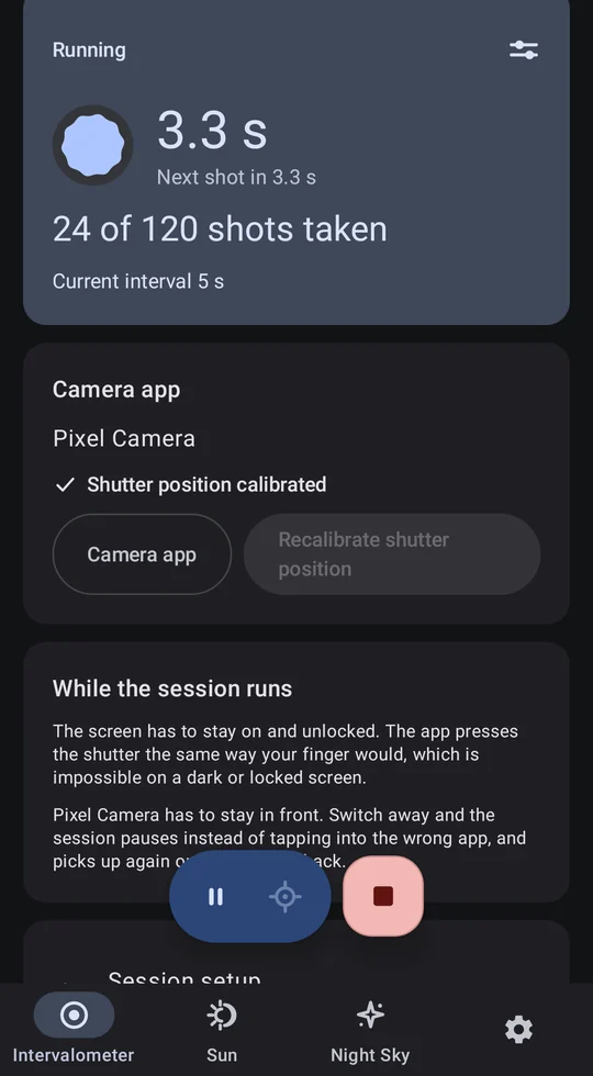
  • A floating panel with countdown, pause and stop that never covers the shutter
  • Optional check that a photo was really taken – and a retry if not
Interval ramping: the interval grows smoothly over the series
A running time-lapse: countdown to the next shot and the number of shots taken
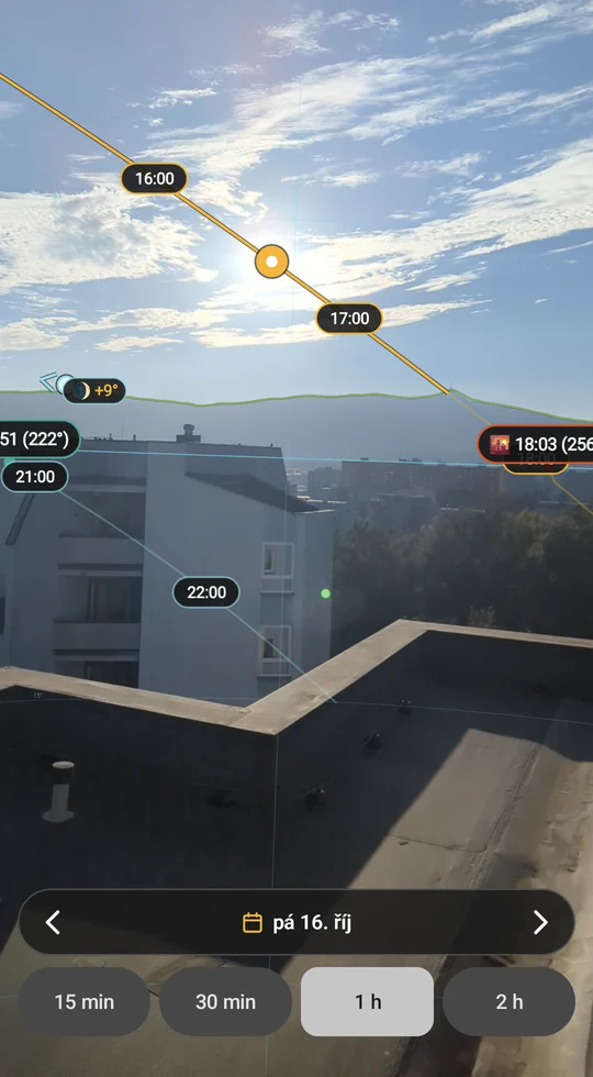
Sun AR: the Sun's path with hourly marks over the camera view and the terrain skyline

Sun & Moon AR

The Sun drops behind the ridge at 18:42 – not at the almanac's 19:07.

  • Sun and Moon paths over the live camera view, with time marks, golden hour and twilight
  • The real horizon from a terrain elevation model
  • Peak names on the skyline – only the ones you can actually see
  • Automatic alignment to the horizon from the camera image
  • Download the terrain once, then it all works with no signal

Night Sky AR

When does Jupiter clear the ridge?

  • Stars, planets, the Moon and the Milky Way over the real landscape
  • 88 illustrated constellations, 110 Messier objects with photos, meteor showers
  • Rise, transit and set times against the real hills
  • A ±12 h time scrubber and any date for planning ahead
  • Search, planetarium mode and a red night mode that keeps your dark adaptation
Night Sky AR: constellations drawn over the sky, with star names

How it works

Three steps to your first series

  1. Pick your camera app

    Google Camera or any other. CAELIS opens it for you when the series starts.

  2. Show it where the shutter is

    One tap marks the shutter button. The position is remembered for that app.

  3. Set the series and start

    Interval, number of shots, ramping and stop conditions – then put the phone on a tripod.
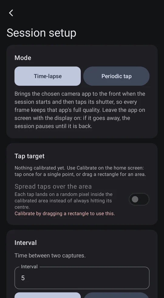
Series setup: interval, number of shots and stop conditions

Privacy first

No ads. No analytics. No account.

  • Terrain only with your consent

    The internet is used only to download terrain and peak names. All that is sent is the name of a 1° × 1° map square – never coordinates.

  • ARCore is off by default

    Optional Google ARCore makes the AR steadier. Before you turn it on, the app tells you what Google receives.

  • Why the accessibility service

    Only to open the camera app you chose and press its shutter, or tap the point you set. Nothing it sees is stored or sent. The AR modules do not need it.

  • Open source

    The whole app is published under GPL-3.0. Read it, build it, check it.

Ready for the next golden hour?

Free on Google Play. Requires Android 11 or newer.